Maps!
I’ve been experimenting with putting geolocation information (GPS coordinates, basically) into photos. I’ve only done a few hundred, but you can already see clusters of images at different locations in Minneapolis.
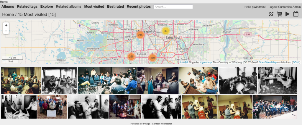
And I finally got the plugin to display this information in the gallery website activated and configured; so now, if you’re in a gallery with geolocation information, there’ll be a map (somewhat inconveniently shaped and located). You can also click on the groups of photos showing on the map to see those photos. (When all the location info I have is a city, I’m using the center of the city or the city hall for the location I add. Mostly we have a little more precise information than that.
I guess this means it’s worth the trouble to add the geolocation information!